Seaside, Oregon To Bruceport County Campground, Washington
- Lucian@going2paris.net

- Jul 24, 2021
- 13 min read

Bruceport County Campground
Bruceport, Washington
July 23, 2021
I continue to see cyclists on US 101 making long distance rides. I am surprised by how many of them appear to solo cyclist ad how many seem to be 40 + year old mean.
US 101 should be named the “”RV Highway”
When I am typing on my phone I keep hitting s instead of a and g instead of h.
The first 50 miles on US 101 in Washington have been beautiful. Lots of water on the left and big green trees on the right. Sparesely developed,
The peninsula when you first get into Washington is lovely — ocean on the left, bay on the right. Many of the houses look simple and older. You can see that new money is coming in and building bigger beautiful houses. Most houses were well off the beach from what I could. Long Beach is a tourist town and then the other towns along the ocean side are smaller and not as touristy. A number of the smaller houses had RVs beside them which suggests to me that those homes are for the summer and folks go elsewhere when the weather turns.
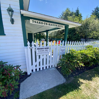
Oysterville was quite charming. I talked to a woman I would guess in her 89s who moved there 12 years ago. She is running a two week science camp. I met a younger fellow helping her who had sold his company to eBay and moved to Oysterville. I had one of those unfulfilling conversations with the woman. Like she’d had enough with me and I was dismissed. Fascinating. Perhaps I didn’t meet her expectations for being well heeled? Or my use of the term entropy made her think I was showing off (I used it in the context of the “chaos” the children were creating).
Yeah, I still want to be liked.

The Columbia River

The Goonies was filmed in Astoria.

The end or the beginning?

Made it over with moderate stress.

Another state

Hmmm. A dispute?

Cape Disappointment


The peninsula is called Long Beach Peninsula and all the streets are numbered. This is the last one.


Can’t say I expected to find a village as pretty as Oysterville out here. Shows what love and money can do.
The Oysterville Oystery was beautiful I didn’t take a chance and have any oysters.
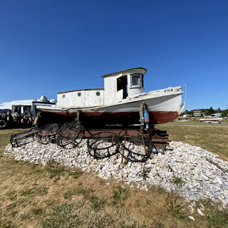
Then it was time to go back south. I really like how this photo turned out. And no, I did not ask permission.

Fairly flat along the US 101.
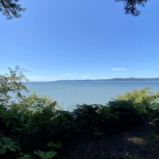
I should note that the water here is not the ocean — it is the Willapa Bay.
At my campsite. The hostess gave me a site with a bay view!
Into South Bend for a dinner of fish (cod) and chips. I like beer batter better.
Sunset from my campsite:
Here is more information about Astoria, Long Beach Peninsula, Long Beach (town), Oysterville and Cape Disappointment.
Astoria
Astoria is a port city and the seat of Clatsop County, Oregon, United States. Founded in 1811, Astoria is the oldest city in the state of Oregon and was the first American settlement west of the Rocky Mountains.[7] The county is the northwest corner of Oregon, and Astoria is located on the south shore of the Columbia River, where the river flows into the Pacific Ocean. The city is named for John Jacob Astor, an investor and entrepreneur from New York City, whose American Fur Company founded Fort Astoria at the site and established a monopoly in the fur trade in the early nineteenth century. Astoria was incorporated by the Oregon Legislative Assembly on October 20, 1876.[1]
The city is served by the deepwater Port of Astoria. Transportation includes the Astoria Regional Airport. U.S. Route 30 and U.S. Route 101 are the main highways, and the 4.1-mile (6.6 km) Astoria–Megler Bridge connects to neighboring Washington across the river. The population was 9,477 at the 2010 census.[8]
History
Pre-historic settlements
During archeological excavations in Astoria and Fort Clatsop in 2012, trading items from American settlers with Native Americans were found, including Austrian glass beads and falconry bells. The present area of Astoria belonged to a large pre-historic, native American trade system of the Columbia Plateau.
19th century
The Lewis and Clark Expedition spent the winter of 1805–1806 at Fort Clatsop, a small log structure southwest of modern-day Astoria. The expedition had hoped a ship would come by that could take them back east, but instead they endured a torturous winter of rain and cold. They later returned overland and by internal rivers, the way they had traveled west. Today the fort has been recreated and is part of Lewis and Clark National Historical Park.
In 1811, British explorer David Thompson, the first person known to have navigated the entire length of the Columbia River, reached the partially constructed Fort Astoria near the mouth of the river. He arrived two months after the Pacific Fur Company's ship, the Tonquin. The fort constructed by the Tonquin party established Astoria as a U.S., rather than a British, settlement and became a vital post for American exploration of the continent. It was later used as an American claim in the Oregon boundary dispute with European nations.
The Pacific Fur Company, a subsidiary of John Jacob Astor's American Fur Company, was created to begin fur trading in the Oregon Country. During the War of 1812, in 1813, the company's officers sold its assets to their Canadian rivals, the North West Company. The fur trade would remain under British control until U.S. pioneers following the Oregon Trail began filtering into the town in the mid-1840s. The Treaty of 1818 established joint U.S. – British occupancy of the Oregon Country.
In 1846, the Oregon Treaty divided the mainland at the 49th parallel north, and the southern portion of Vancouver Island south of this line was awarded to the British.
Washington Irving, a prominent American writer with a European reputation, was approached by John Jacob Astor to mythologize the three-year reign of his Pacific Fur Company. Astoria (1835), written while Irving was Astor's guest, promoted the importance of the region in the American psyche. In Irving's words, the fur traders were "Sinbads of the wilderness", and their venture was a staging point for the spread of American economic power into both the continental interior and outward in Pacific trade.
As the Oregon Territory grew and became increasingly more colonized by Americans, Astoria likewise grew as a port city near the mouth of the great river that provided the easiest access to the interior. The first U.S. post office west of the Rocky Mountains was established in Astoria in 1847 and official state incorporation in 1876.
Astoria attracted a host of immigrants beginning in the late 19th century: Nordic settlers, primarily Swedes, Swedish speaking Finns and Chinese soon became larger parts of the population. The Nordic settlers mostly lived in Uniontown, near the present-day end of the Astoria–Megler Bridge, and took fishing jobs; the Chinese tended to do cannery work, and usually lived either downtown or in bunkhouses near the canneries. By the late 1800s, 22% of Astoria's population was Chinese.
20th and 21st centuries
In 1883, and again in 1922, downtown Astoria was devastated by fire, partly because the buildings were constructed mostly of wood, a readily available material. The buildings were entirely raised off the marshy ground on wooden pilings. Even after the first fire, the same building format was used. In the second fire, flames spread quickly again, and the collapsing streets took out the water system. Frantic citizens resorted to dynamite, blowing up entire buildings to create fire stops.
Astoria has served as a port of entry for over a century and remains the trading center for the lower Columbia basin. It has long since been eclipsed in importance by Portland, Oregon, and Seattle, Washington, as economic hubs on the coast of the Pacific Northwest. Astoria's economy centered on fishing, fish processing, and lumber. In 1945, about 30 canneries could be found along the Columbia River.
As the Pacific salmon resource diminished, canneries were closed. In 1974, the Bumble Bee Seafoods corporation moved its headquarters out of Astoria and gradually reduced its presence until closing its last Astoria cannery in 1980. The lumber industry likewise declined in the late 20th century. Astoria Plywood Mill, the city's largest employer, closed in 1989. The Burlington Northern and Santa Fe Railway discontinued service to Astoria in 1996, as it did not provide a large enough market.
The Astoria–Megler Bridge.
From 1921 to 1966, a ferry route across the Columbia River connected Astoria with Pacific County, Washington. In 1966, the Astoria–Megler Bridge was opened. The bridge completed U.S. Route 101 and linked Astoria with Washington on the opposite shore of the Columbia, replacing the ferry service.
Today, tourism, Astoria's growing art scene, and light manufacturing are the main economic activities of the city. Logging and fishing persist, but at a fraction of their former levels. Since 1982 it has been a port of call for cruise ships, after the city and port authority spent $10 million in pier improvements to accommodate these larger ships.
To avoid Mexican ports of call during the Swine Flu outbreak of 2009, many cruises were re-routed to include Astoria. The floating residential community MS The World visited Astoria in June 2009.
The town's seasonal sport fishing tourism has been active for several decades. Visitors attracted by heritage tourism and the historic elements of the city have supplanted fishing in the economy. Since the early 21st century, the microbrewery/brewpub scene and a weekly street market have helped popularize the area as a destination.
The Astoria Column.
In addition to the replicated Fort Clatsop, another point of interest is the Astoria Column, a tower 125 feet (38 m) high, built atop Coxcomb Hill above the town. Its inner circular staircase allows visitors to climb to see a panoramic view of the town, the surrounding lands, and the Columbia flowing into the Pacific. The tower was built in 1926. Financing was provided by the Great Northern Railway, seeking to encourage tourists, and Vincent Astor, a great-grandson of John Jacob Astor, in commemoration of the city's role in the family's business history and the region's early history.
Since 1998, artistically inclined fishermen and women from Alaska and the Pacific Northwest have traveled to Astoria for the Fisher Poets Gathering, where poets and singers tell their tales to honor the fishing industry and lifestyle.
Another popular annual event is the Dark Arts Festival, which features music, art, dance, and demonstrations of craft such as blacksmithing and glassblowing, in combination with offerings of a large array of dark craft brews. Dark Arts Festival began as a small gathering at a community arts space. Now Fort George Brewery hosts the event, which draws hundreds of visitors and tour buses from Seattle.
Astoria is the western terminus of the TransAmerica Bicycle Trail, a 4,250-mile (6,840 km) coast-to-coast bicycle touring route created in 1976 by the Adventure Cycling Association.
Three United States Coast Guard cutters: the Steadfast, Alert, and Fir, are based at the port of Astoria.
In popular culture and entertainment
It is claimed that the actor Clark Gable began his career at the Astoria Theatre in 1922.
Leroy E. "Ed" Parsons, called the "Father of Cable Television", developed one of the first community antenna television stations (CATV) in the United States in Astoria starting in 1948.
The early 1960s television series Route 66filmed the episode entitled "One Tiger to a Hill"[59] in Astoria; it was broadcast on September 21, 1962.
A scene in "The Real Thing"—Episode 2 of Season 5 (in the 7th year) -- of the television series Eureka (American TV series) was set in Astoria. The character Jo Lupo parks her vehicle in an unauthorized location while she is meditating on the oceanfront. A tow truck is called to remove the vehicle. A law enforcement officer whose shoulder clearly displays a patch that reads "Astoria, Oregon" speaks to Jo about the parking violation.
Shanghaied in Astoria is a musical about Astoria's history that has been performed in Astoria every year since 1984.
In recent popular culture, Astoria is most famous for being the setting of the 1985 film The Goonies, which was filmed on location in the city. Other notable movies filmed in Astoria include Short Circuit, The Black Stallion, Kindergarten Cop, Free Willy, Free Willy 2: The Adventure Home, Teenage Mutant Ninja Turtles III, Benji the Hunted, Come See the Paradise,The Ring Two, Into the Wild, The Guardian and Green Room.
Pop punk band The Ataris' fourth album was titled So Long, Astoria as an allusion to The Goonies. A song of the same title is the album's first track. The album's back cover features news clippings from Astoria, including a picture of the port's water tower from a 2002 article on its demolition.
Pop punk band Marianas Trench have an album titled Astoria. The band states the album was inspired by 1980s fantasy and adventure films, and The Goonies in particular. That film inspired the title, as it was set in Astoria, the album's artwork, as well as the title of their accompanying US tour (Hey You Guys!!).
Long Beach Peninsula
The Long Beach Peninsula is an arm of land on the southern coast of the state of Washington. Entirely within Pacific County, it is bounded on the west by the Pacific Ocean, the south by the Columbia River, and the east by Willapa Bay. Leadbetter Point State Parkand Willapa National Wildlife Refuge are at the northern end of the peninsula and Cape Disappointment is at the southern end, with Pacific Pines State Park located in between.
The Long Beach Peninsula is known for its continuous sand beach 28 miles (45 km) in extent on the Pacific Ocean side, claimed to be the longest beach in the United States. It is a popular vacation destination for people from Seattle, Washington (165 miles (266 km) distant) and Portland, Oregon (115 miles (185 km) distant).
Geography
Due to its low elevation and coastal location, the peninsula is at high risk of severe damage in the event of a tsunami.
Economy
The principal industry of the Long Beach Peninsula has become tourism, though fishing, crabbing, oyster farming, and cranberry farming are also important components of the local economy. The Long Beach Peninsula is located on the west side of the Willapa Bay, considered the number one producer of farmed oysters in the United States and among the top five producers worldwide.
The Long Beach Peninsula has become one of the most popular tourism destinations in the State of Washington and has attracted visitors from all over North America. As one of the final destinations of the Lewis and Clark Expedition, several television specials have brought publicity to this area. A multitude of events and festivals are held throughout the year including the Washington State International Kite Festival, the Sandsations sandcastle sculpting competition, and the annual The Rod Run to the End of the World, which attracts thousands of visitors on the weekend following Labor Day.
Cities and towns
Ilwaco
Long Beach
Nahcotta
Ocean Park
Oysterville
Seaview
Oysterville
Oysterville is an unincorporated community located along Willapa Bay on the Long Beach Peninsula in Pacific County, Washington. It is approximately 5 miles (8.0 km) from the city of Ocean Park, and 15 miles (24 km) from Long Beach. Founded in 1841 as an oyster fishing village, the community is registered on the National Register of Historic Places as the Oysterville Historic District. It currently has a population of about 20 residents.
History
Before Oysterville was given its English name, it was the site of shellfish cultivation and harvesting by Indigenous people. John Douglas, who emigrated, was one of the first white men in the area. Oysterville was established and named in 1854 by J.A. Clark. It was a hub of oyster farming as the name suggests. It was the seat of Pacific County until the seat was relocated to South Bend in 1893.
In a county seat war, on February 3, 1893, all of the county records and books were stolen in order to move the county seat from Oysterville to South Bend, Washington. However, it had been agreed upon that the seat would be moved to South Bend. There is a sign telling the story of this incident across from the historic Oysterville school.
The town has several historic buildings, including a school house and historic homes, many built prior to 1880. Most of the buildings in this once prosperous town have been lost to the sea and the elements. Oysterville was placed on the National Register of Historic Districts in 1976 as Oysterville Historic District.
Just outside the town is the historic Oysterville Cemetery, which was begun in 1858 and contains plots for many of the area's founding families.
Long Beach
Long Beach is a city in Pacific County, Washington. The population was 1,392 at the 2010 census.
History
Long Beach began when Henry Harrison Tinker bought a land claim from Charles E. Reed in 1880. He platted the town and called it "Tinkerville.". Long Beach was officially incorporated on January 18, 1922. From 1889 to 1930, a narrow gauge railroad called the Ilwaco Railway and Navigation Company ran up the whole peninsula.
The Long Beach depot was built between First and Second Streets on the east side of the track, which ran north along "B" Street. A major destination in Long Beach was Tinker's Hotel, later renamed the Long Beach Hotel, and built very close to the station. This was the second hotel built at the site by Henry Harrison Tinker, the founder of Long Beach. Tinker's first hotel burned down in 1894. He built another one just a few feet to the east and south of the rail depot. The image in the gallery shows a crowd waiting for the train sometime between 1901 and 1907. Just across the tracks (which doubled in this area) from Tinker's Hotel in Long Beach was the Portland Hotel. The Portland Hotel, owned by the Hanniman family featured an enormous round (and unique) turret-like structure. The Portland Hotel burned down on December 6, 1914, and was not replaced. The Driftwood Hotel was another common Long Beach destination.
The boardwalk area near the station was known as "Rubberneck Row."
Businesses existing in August 1911 that can be identified along Rubberneck Row from photographs (see images in this article) include, on the west side of the tracks, an establishment advertising "Baths" (possibly the Crystal Baths, an indoor swimming pool), Milton York Candies, a "Postal Shop," and a soda fountain just across from the station advertising "Milk Shake." A somewhat earlier photograph shows a sign for a livery stable immediately to the west across the tracks from Tinker's Hotel, followed (proceeding southwards) by a barber shop, "Vincent's Souvenirs," and "The Candy Man". A banner stretching above the tracks advertises a restaurant. The photo published by Feagans shows it was produced by H.A. Vincent, Ilwaco and Long Beach, who was probably the owner of Vincent's Souvenirs. Then, in the late 80s, Marsh's Free Museum was made, to show people the wonders of the northwest.
Cape Disappointment
Cape Disappointment is a headland of the Pacific Northwest, located at the extreme southwestern corner of Washington, United States, on the north side of the Columbia River bar and just west of Baker Bay. The point of the cape is located on the Pacific Ocean in Washington's Pacific County, approximately two miles (3.2 km) southwest of the town of Ilwaco. Cape Disappointment sees about 2,552 hours of fog a year—the equivalent of 106 days—making it one of the foggiest places in the U.S.
The cape was named on July 6, 1788, by British fur trader John Meares, who was sailing south from Nootka Island, Canada, in search of trade. He mistook the mouth of the Columbia River to be a bay, which the ship could not enter due to a shallow shoal. Just missing the discovery of the river mentioned by Francisco Antonio Mourelle, he named them Cape Disappointment and Deception Bay. George Vancouver credits John Meares in his account when he saw Cape Disappointment on April 27, 1792.
Cape Disappointment State Park is located on the cape, as is the Cape Disappointment Lighthouse. United States Coast Guard Station Cape Disappointment is situated on the river near the state park. The station's crewmembers respond to 300–400 calls for assistance every year.














Comments